
Gps Tracking and Monitoring
Delorme Street Atlas
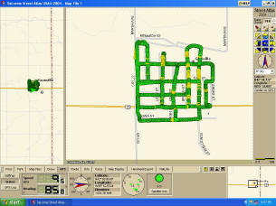
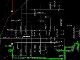
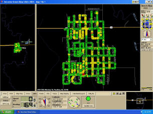
MCI utilizes a program called Delorme Street atlas it provides the Driver with real-time tracking of their location and current speed while they treat a town. Delorme Street atlas also provides a trail as to where the Driver has been allowing MCI to ensure we have covered every avenue of approach. These files are then saved after completion of a town for later reference. Although the software is no longer on the market, we still continue to update our maps to ensure that no new developments are being missed.
Verizon Connect Reveal
The Second Software / hardware we utilize is Verizon Connect Reveal. This provides our office with the ability to track all the trucks current location, direction and speed simultaneously. This allows us to dispatch accordingly and ensure all jobs are being completed in an accurate and timely manner. Verizon provides a detailed instant replay that our office can review at a later time
Contact Us Today For More Information
(712-848-3295) 402 Broad Street Rolfe, Iowa 50581
mosquito@iowatelecom.net